
Private access road to Barefoot Campsites

Directions by Car
 Barefoot Campsites lie approximately 1 1/2 miles from the A420 Oxford to Swindon Road.
The campsite is 6 miles from the A34 Marcham Interchange at Abingdon and 6.6 miles from the A34 Botley Interchange.
The A34 links Oxford to the Midlands via the M40; to London via either the M40 or the M4; to Bath and Bristol via the M4; or on the A34 itself to Southampton and Bournemouth on the south cost, so getting to us is easy!
…using a map from A420 Oxford – Swindon
-
- Follow the signs for Appleton, turning off A420 into ‘Oaksmere‘
- Follow this road into Appleton village.
- When you reach the war memorial, turn right.
- Take the 2nd left turn into Badswell Lane (signposted to Appleton Tennis Courts), then follow the directions below.
…using a Sat Nav
-
- Please don’t use the Waze App – it sends you to our neighbours across the river: A VERY nice house, and a lovely family, but definitely not the campsite. It’s 6.8 miles drive back to the campsite via Newbridge!
-
- For other Sat Navs and Google searches, please use the postcode OX13 5JN This will get you to Badswell Lane, Appleton, then follow the directions below.
…from Badswell Lane
- Continue along Badswell Lane until you reach the last house on the right.
- Immediately after this house,
 and before the tennis courts, turn right onto a gated tarmac road. (There is a small blue notice at the top of the road which reads: ‘Environment Agency – No Public Right of Way – Lock Access Only’ Don’t worry, it’s our road. The Environment Agency lease a right of access over it to reach the lock house and manage the lock and weir)
 - Follow this road for about 2/3 miles down onto the flood plain, towards the River Thames and Northmoor Lock Paddocks, home of Barefoot Campsites
 and before the tennis courts, turn right onto a gated tarmac road. (There is a small blue notice at the top of the road which reads: ‘Environment Agency – No Public Right of Way – Lock Access Only’ Don’t worry, it’s our road. The Environment Agency lease a right of access over it to reach the lock house and manage the lock and weir)
…using what3words
- If you use what3words, the campsite office is located at: ///tasks.tins.daunted
 the campsite office is located at:
Directions by Bus
 Major works to rebuild the railway bridge in Oxford, since April 2023, has meant the busses stop short of the railway station, so, if you’re coming from Oxford you’ll have to take the footpath under the railway lines to get onto the Botley Road. It’s then a short walk over Osney Bridge to the bus stops close to St Frideswide Church.
There are 2 possible bus options – Thames Travel 63 and Stagecoach S6
Thames Travel 63 and 63S do pass through Appleton, stopping at the Post Office, but it’s a very limited timetable and doesn’t run at the weekend: Oxford Bus Company Thames Travel 63 and 63S
Stagecoach operate the S6 This is/was also a regular bus service which runs between Oxford and Swindon but it no longer passes through Appleton. It stops on A420 at the top of Oaksmere from where it is a walk of just under a mile into Appleton and a further half mile to the campsite.
Stagecoach have a fancy new website. I have pre-loaded the link below with the start and end points of your journey if you’re coming from Oxford Railway Station (preset for 24th May 2024, leaving Oxford at 2pm.)
You will need to Change Journey by entering your travel date and the time you want to leave Oxford. View Itinerary will give you the actual route the bus follows: Stagecoach S6 (There are some times for the S9 but I’m sure that’s not correct as the S9 goes to Wantage. I think that’s a typo)
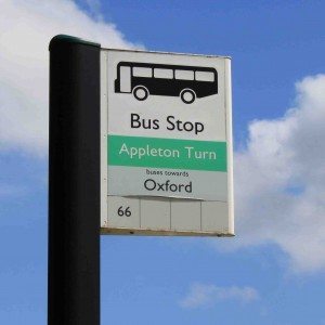
This is a link to the S6 timetable to give you a more traditional view. Your journey will begin at Oxford Osney Island for 7 stops, getting off at Tubney Appleton Turn, just after the roundabout.
Oxford Bus Company Stagecoach S6 Timetable

It’s then a 1.6 mile, 37 minute walk to the campsite. It’s not a great road for pedestrians – no footpath and the road itself is not that wide. Walk on the right when you can so that you face the oncoming traffic.
Key in Appleton Turn Appleton and Barefoot Campsites
Other Bus Routes
If you need to use public transport to get to one of the bus routes which serve Appleton, you may find the following website helpful to plan your route:
- Transport Map Countries tab, select UK
- select Oxford Bus Map
- click on Stagecoach
- click through the various bus route maps
Download information
Directions by train
 The closest train station is the main Oxford station (approximately 6 miles) – not to be confused with the new Oxford Parkway!
Taxis from Oxford Railway Station
Because of the road closure, which started in April 2023, is likely to continue well into 2026, Royal Cars and 001 taxi firms tell me they are no longer offering services on this side of the railway. Not quite sure how true that is – but there are certainly no taxi ranks on this side (which is true as apparently no temporary Taxi Rank was put in place when the road closed in April 2023!) but they may do pickups for booked taxis.
 Go Green Taxis definitely will pick you up but you will need to book. When booking, you’ll need to ask for a pick up from Westgate Hotel, through to OX13 5JN (Badswell Lane, Appleton) You’ll need to exit the railway station through the main entrance and cross under the railway line via the walkway. The Westgate Hotel is on your left at the end of this footpath. The cost will be somewhere between £31 and £41 depending on the day and time. Don’t forget to book a pick up from the campsite on Sunday. They have various phone numbers but all go through to the central office on 01865 922 222 (I don’t have shares in Go Green but they were the most helpful when trying to negotiate the current chaos of roads into and out of Oxford from West Oxfordshire)
If you’re picking up a taxi from elsewhere, be sure to check that the taxi driver is taking you to/picking you up from Appleton (you don’t want him going to Northmoor as this is on the opposite side of the river and it’s a 6.6 mile drive to get back to the Appleton side!), then give the taxi driver the information provided for arriving by car.
Some taxi driver use the WAZE app – don’t let them do this – for some reason the postcode for Badswell Lane takes them to the wrong side of the river!
There are busses from close-ish, to the train station – see Directions by Bus – but these don’t get you quite as far as the campsite.
Other train stations:
There are 2 other possible stations: Didcot Parkway and the now not so new Oxford Parkway station near Kidlington. There are no convenient busses from either of these stations so you’ll need to take a taxi or ask a friend to collect you. A 001 taxi from Oxford Parkway is likely to be around £28 and from Didcot around £32 With the traffic issues around Oxford, especially during rush hour, I’d opt for Didcot Parkway if you have a choice.
Hope that’s helpful!
Download information